
Kigali to Volcanoes National Park,
The road from Kigali to Volcanoes National Park is a scenic journey in its own right. In about two to three hours you leave the capital’s tidy boulevards and climb through steep, farmed hills, then reach the volcanic highlands of the north-west, where the Virunga peaks rise above the fields. Here is what to expect and where to stop.
The Basics
The distance from Kigali to the park headquarters at Kinigi is roughly 100 to 115 km, depending on your starting point in the city. The road is paved and in generally good condition, and the journey usually takes between two and three hours. Early-morning traffic leaving Kigali, trucks on the climbs and the occasional roadworks can all add time.
Most visitors do this drive for gorilla trekking, which has one important consequence for timing. Trekkers are expected at the Kinigi headquarters in the early morning, usually around 7:00 a.m., for a briefing and group allocation. If you want to travel on the day, you would need to leave Kigali before 5:00 a.m. Most people instead drive up the afternoon before and sleep in or near Musanze, which is far more relaxing and gives you time to enjoy the route. Confirm briefing times and permit conditions with the Rwanda Development Board (RDB) or your operator, as details can change.
You can hire a driver-guide, which is the most popular option, or self-drive. Rwanda drives on the right, the main route is straightforward to navigate, and signage is decent. Public buses and minibuses run from Nyabugogo bus station to Musanze, but getting from Musanze to Kinigi and organizing park access is easier with private transport.
Leaving Kigali
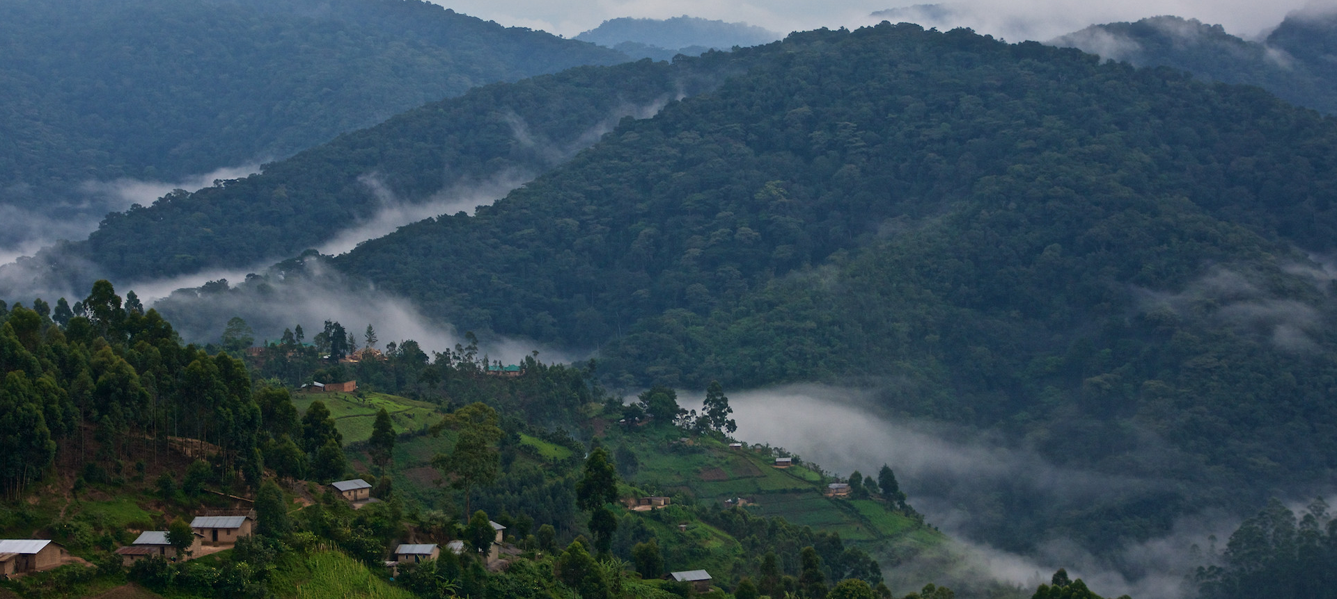
The route heads north out of the city through Nyabugogo, the busy transport hub in a low valley, and climbs onto the ridges that define the country’s landscape. Rwanda’s nickname, the Land of a Thousand Hills, makes sense within the first half hour, when the road begins to wind up and down through a patchwork of hillside plots.
If you have time before leaving, the Kigali Genocide Memorial is one of the most important places to visit in the country, and many travelers go the day before or after their trip north. It gives essential context for everything else you will see in Rwanda.
The Road North: Shyorongi to Gakenke
Beyond the city’s edge, the route passes through Shyorongi and on toward Base, in a stretch of rolling farmland where roadside stalls sell fruit and vegetables. You will pass small trading centres, schoolchildren in uniform, and cyclists hauling impressive loads of bananas, charcoal and sacks of produce. Pull over, if it is safe, to see how the hills are farmed. The terracing is meticulous, and the colors change with the seasons.
As you approach Gakenke, the terrain becomes more dramatic. The road climbs and descends through tight bends with deep valleys on either side, and the views from the ridgelines are among the best of the trip. This is a good place for photo stops at designated pull-offs, but keep clear of the road, as trucks are frequent and visibility on corners is limited. Take your time on this section, especially in rain or mist, when the road can be slick.
Along this stretch you can also sample local life. Roadside vendors sell roasted maize, bananas and seasonal fruit, and the little towns have simple restaurants where you can have a coffee or a brochette. Carry some small Rwandan franc notes for these stops.
Crossing the Mukungwa Valley
Closer to Musanze, the road drops toward the Mukungwa River valley. This lower area is greener and more open, and you start to sense the change in geography. The land flattens a little and the soil darkens, a sign of the volcanic geology ahead. Potatoes are a major crop in this region, and the cooler, fertile highlands around Musanze are among the country’s key agricultural zones. In places you will see large fields stretching up the lower slopes of the volcanoes.
Arriving in Musanze
Musanze, formerly known as Ruhengeri, is the main town of the region and the usual base for visiting the park. It is lively and practical, with markets, banks, ATMs, restaurants, fuel stations and a wide range of accommodation, from budget guesthouses to luxury lodges. If you are arriving the day before your trek, this is a good place to stock up on water, snacks, rain gear and any last-minute supplies.
On a clear day, the Virunga volcanoes come into view as you reach the town, and they dominate the skyline. The peaks are often wrapped in cloud, so catching an early-morning or late-afternoon view is a treat. The range includes Karisimbi, the highest at about 4,500 meters, along with Bisoke, Muhabura, Gahinga and Sabyinyo.
Worthwhile Stops Around Musanze
If you have a spare half day, the area around Musanze offers more than most people expect.
Musanze Caves. Just outside town, these extensive lava tubes formed by ancient volcanic activity can be explored on a guided visit. They are a good option for people who want something active but not as demanding as a trek.
Twin Lakes: Burera and Ruhondo. These two lakes sit in a scenic, hilly area north of the town. The shores are dotted with fishing communities, and the surrounding landscape is peaceful and photogenic. Several lodges are set above the water, and the area is excellent for a short excursion or a lakeside lunch.
Cultural experiences. Community-based tourism projects near the park offer village walks, traditional dance, craft-making and storytelling. Spending a little time here is a good way to support local communities directly and understand life around the park.
Dian Fossey’s grave and Karisoke. The famous primatologist is buried near the Karisoke research camp, up the slopes of Mount Bisoke. Guided hikes are possible through the park and make a rewarding alternative or complement to gorilla trekking, particularly for visitors interested in the history of gorilla conservation.
Reaching Kinigi and the Park
From Musanze, the road to the park headquarters at Kinigi takes around 20 to 30 minutes. The surroundings change noticeably as you go. Fields are enclosed by dark volcanic stone walls, the air gets cooler, and the volcanic cones loom ever larger. The park sits at high altitude, so mornings can be chilly and damp even in the dry season.
At Kinigi, rangers and guides gather trekkers for a briefing, assign groups to gorilla families, and explain safety and conduct rules. Treks begin from different trailheads and range from relatively easy to strenuous, depending on where the gorillas are that day. Besides mountain gorillas, the park offers golden monkey tracking, which is usually shorter and less demanding, along with volcano hikes and the Fossey grave excursion.
Permit prices and rules are set by RDB and have changed over the years, so check the current requirements before you finalize plans. Permits are limited and often sell out in peak seasons, so book well in advance.
Practical Tips for the Drive
- Start early. Morning light is best for photography, and you avoid the heaviest traffic.
- Dress in layers. Kigali is warm, but Musanze and the park are noticeably cooler and often wet.
- Pack for rain. Weather in the highlands changes quickly, and the rainy seasons can bring heavy downpours that slow traffic.
- Carry cash. Roadside stops and small shops usually prefer Rwandan francs, though ATMs are available in Musanze.
- Mind the road. Pedestrians, bicycles and motorbikes share the road, and speed limits are enforced. Drive defensively on the winding stretches.
- Be respectful with cameras. Ask before photographing people, especially children and anyone going about their daily work.
- Travel the day before. It reduces stress, gives you time to explore, and means you will be fresh for the trek.
Final Thoughts
The drive from Kigali to Volcanoes National Park offers a cross-section of Rwanda in a few hours: the orderly capital, the terraced farmland of the central hills, the fertile valleys around Musanze and finally the volcanoes themselves. Giving yourself time to stop, look and talk to people along the way turns a simple transfer into one of the more memorable parts of the trip. By the time you reach Kinigi, you will have a much better sense of the landscape and communities that surround the park, and of why this corner of Rwanda is so special.